
Description
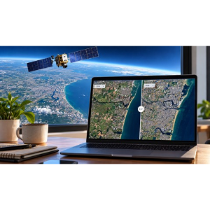
“Build a Satellite Imagery Web App with Python & Flask” is a course—published by the online academy Udemy—focused on building web applications for accessing, displaying, and exploring satellite imagery using Python and the Flask framework. You will learn how to build a web application from scratch, define routes and views, handle user requests, and connect Python backend logic to an interactive frontend user interface. The course introduces fundamental concepts such as working with geospatial data, integrating external APIs or imagery services, processing image data, and presenting satellite imagery through a user-friendly web interface. You will explore how to organize application components, manage data requests, display map-based imagery, and implement features that facilitate navigation and the interpretation of geographic information. Through hands-on development, you will strengthen your Python and Flask skills and learn to leverage web technologies to build applications centered on remote sensing and geospatial data.
Whether you are a Python developer, a newcomer to web development, a geography enthusiast, or an aspiring developer of geospatial applications, this course provides a practical foundation for building satellite imagery web apps and expanding your skills in Python-based web development. Throughout this course, you will build a complete web application for satellite imagery. You will search for and retrieve real Sentinel-2 imagery using STAC, work with geographic coordinates, process and enhance RGB images from satellite data, analyze historical imagery, and finally deploy the complete application to the web using GitHub and Render. This journey provides a deep, practical understanding of how these concepts are applied in real-world scenarios, preparing you to develop professional geospatial applications.
What you will learn in Build a Satellite Imagery Web App with Python & Flask:
- Build a satellite imagery web application using Python and Flask.
- Search and retrieve real Sentinel-2 satellite imagery using STAC.
- Work with geographic coordinates and extract satellite imagery for a location.
- Process, enhance, and create RGB images from satellite data using Python.
- Explore historical satellite imagery and create interactive before-and-after comparisons.
- and …
Course specifications
Publisher: Udemy
Instructors: Vijayarajan Ramanathan
Language: English
Level: Introductory to Advanced
Number of Lessons: 20
Duration: 3 hours and 38 minutes
Course topics

Build a Satellite Imagery Web App with Python & Flask Prerequisites
A computer with Python and a code editor such as Visual Studio Code.
No prior experience with GIS, remote sensing, or satellite data is required.
Basic Python programming knowledge is helpful, but no prior experience with satellite imagery or Earth Observation is required.
Pictures

Build a Satellite Imagery Web App with Python & Flask introduction video
Installation guide
After Extract, watch with your favorite Player.
English subtitle
Quality: 1080p
Downloadly link
Rapidgator link
File password (s): www.downloadly.ir
Size
2.3 GB